We are an official distributor of GEOSUN and BLV Tech products.
LiDAR technology is a method for measurement and remote sensing. Thanks to the use of laser beams, it can map and replicate a faithful 3D environment. Its use is really wide. It is used in many industries, geodesy, geography, geomorphology, seismology, precision agriculture, forestry, mining and quarrying, roads and railways, infrastructure inspection, landfills, water management, power lines and archaeology.
Choosing the right solution and utilizing LiDAR can be complicated. SKYMOVE offers a complete hardware and software package and multiple options to meet the demands of applications, performance and a favorable price. Our team of experts can help you choose the right solution for your focus and projects.
Why choose our products?
- The capabilities of our system that meet different requirements for accuracy and project budget.
- Our software facilitates the creation of outputs thanks to stepwise data processing.
- We provide comprehensive training and support to help you get the most out of your system.
- We use a proven workflow to increase efficiency and increase productivity.
What is included in the price? Every LiDAR system includes everything you need to capture and process LiDAR data.
- The hardware you need to collect data from the field.
- Software for initial data processing
- Comprehensive training and work process for easy and effective generation of results.
- Warranty service and firmware update
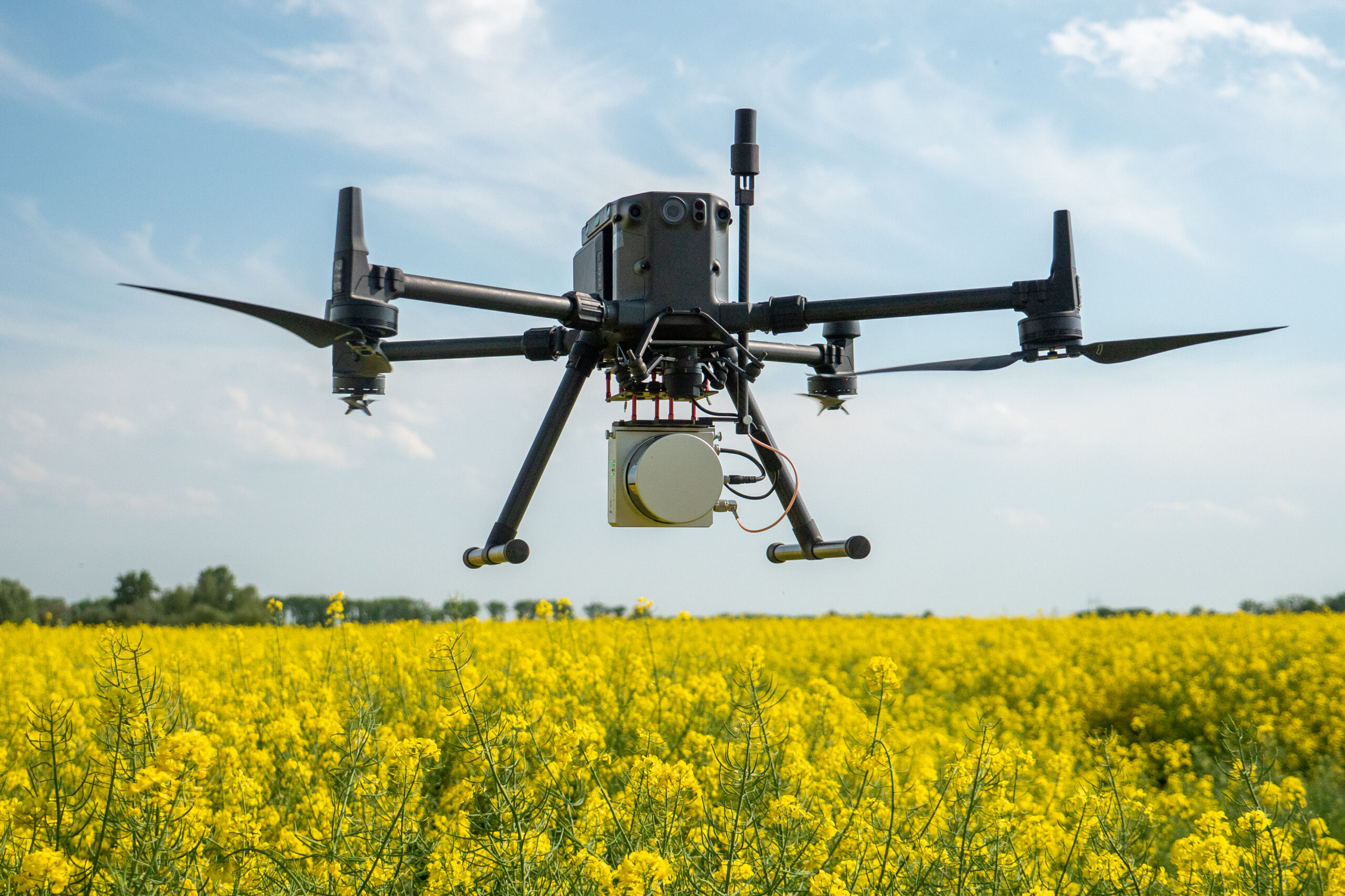
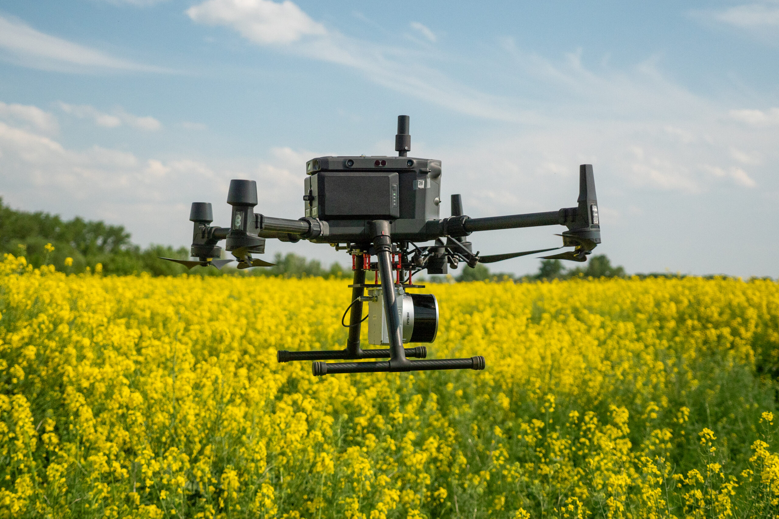
Measuring system GS-130X + DJI Matrice 350
The measurement system consists of a LiDAR unit with IMU, unmanned vehicle, accessories for its operation and a ground station for measuring data during scanning but also for control measurements or other tasks. We deliver the system tested, calibrated and ready for immediate use. The system is capable of performing in both hot and cold conditions.
DJI M300/M350 RTK with complete accessories
GEOSUN GS 130X with HESAI sensor and accessories
Ground measuring station GEOS GPS GNSS MINI 10 with accessories
GS-100G
High-quality handheld scanning system LiDAR system developed for fast and efficient SLAM scanning in the city as well as in the forest.
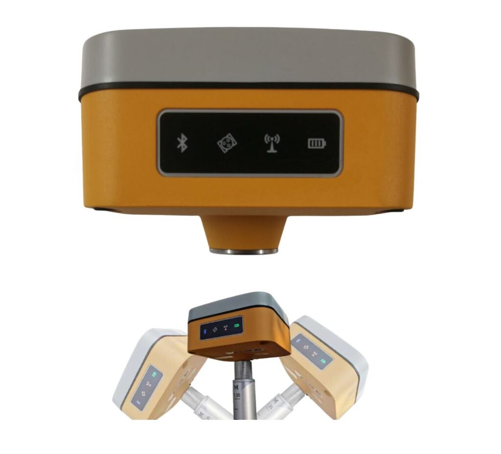
GPS GNSS MINI 10
Useful and compact machine. This type of GPS GNSS device guarantees fast, flexible and reliable measurements in the field.
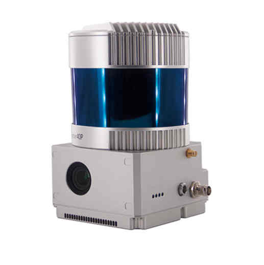
GS-260F
It can quickly obtain a highly accurate and clear laser point cloud. 360° field of view for wider scanning range and higher operational efficiency.
GS-2000N
The most advanced solution from GEOSUN. Lidar designed for data collection on large areas even by aircraft. An effective and accurate tool for the most complex projects.
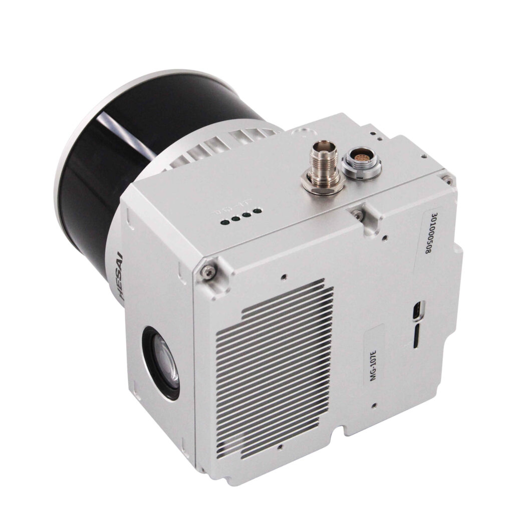
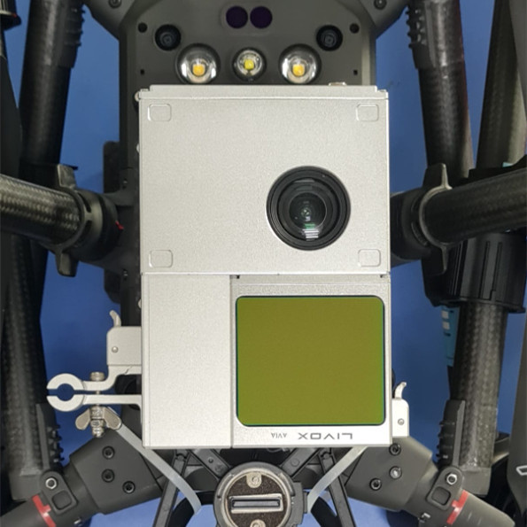
GS-100V
Compact high-quality system for collecting spatial data and short-range point clouds with integrated 16-channel HESAI XT16 laser scanner.
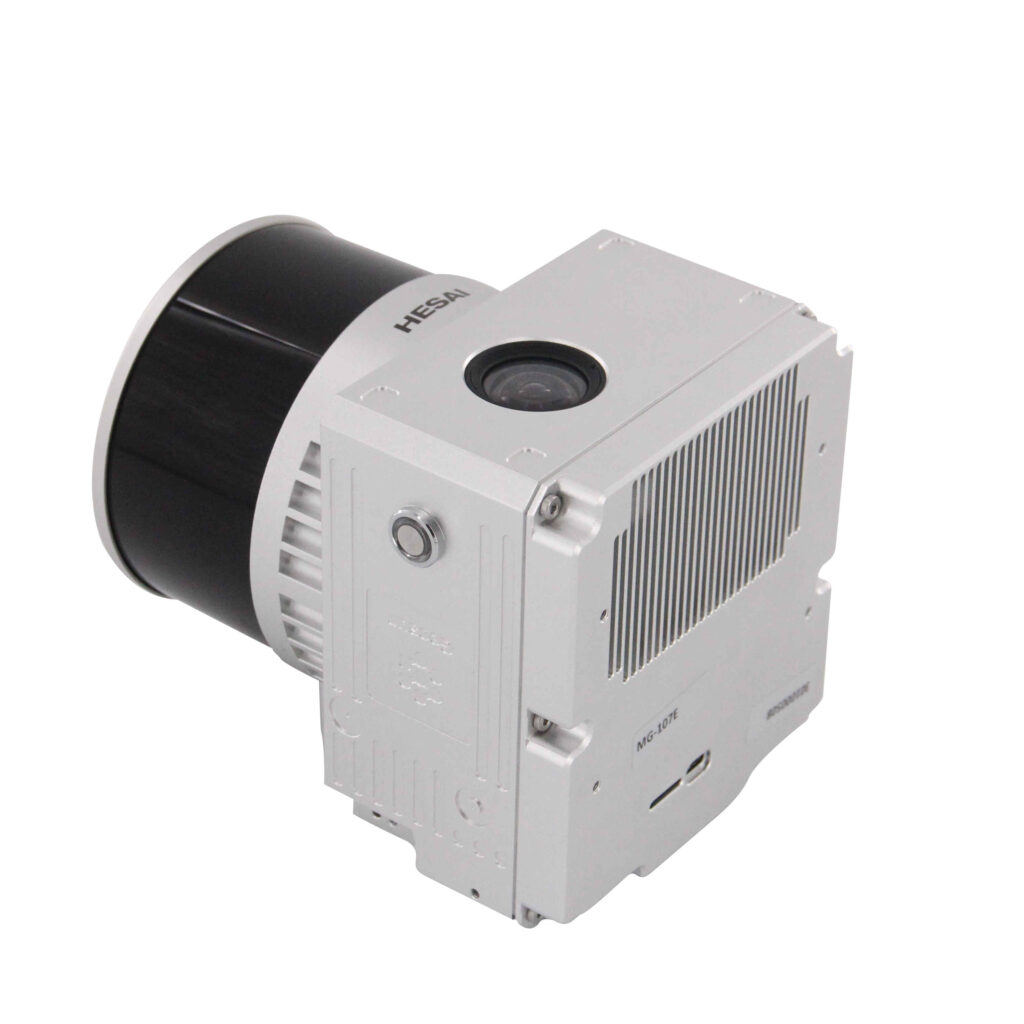
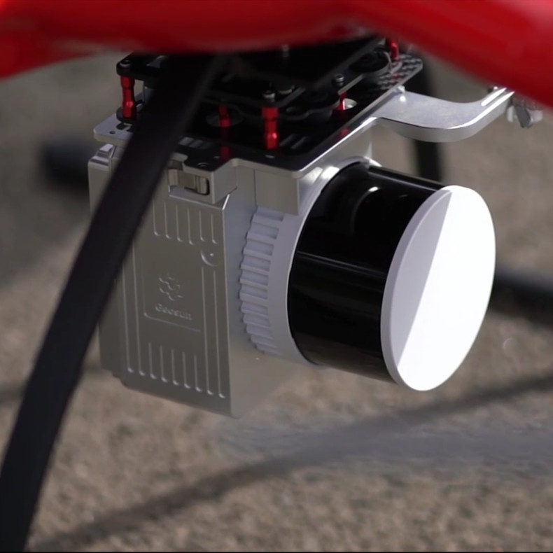
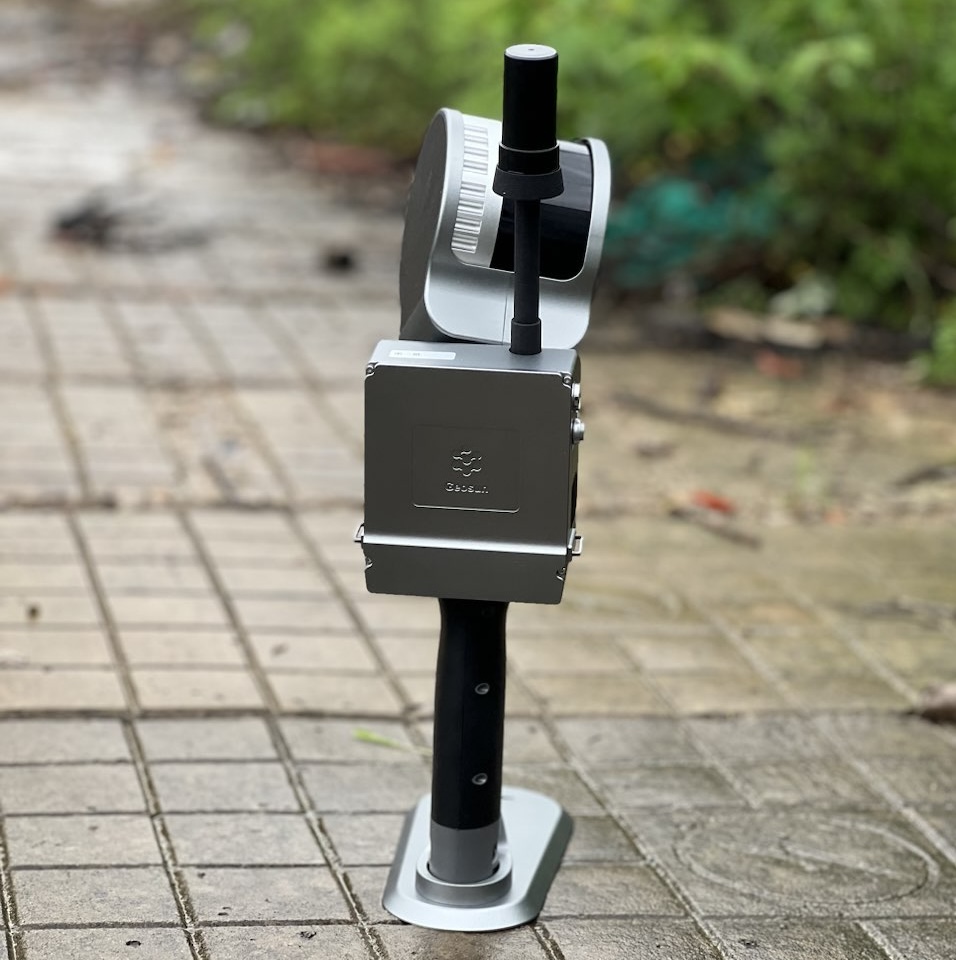
GS-130X
Advanced and accurate LiDAR tool for measuring both short and longer ranges with the excellent 32-channel HESAI XT32 sensor. A proven and affordable solution.
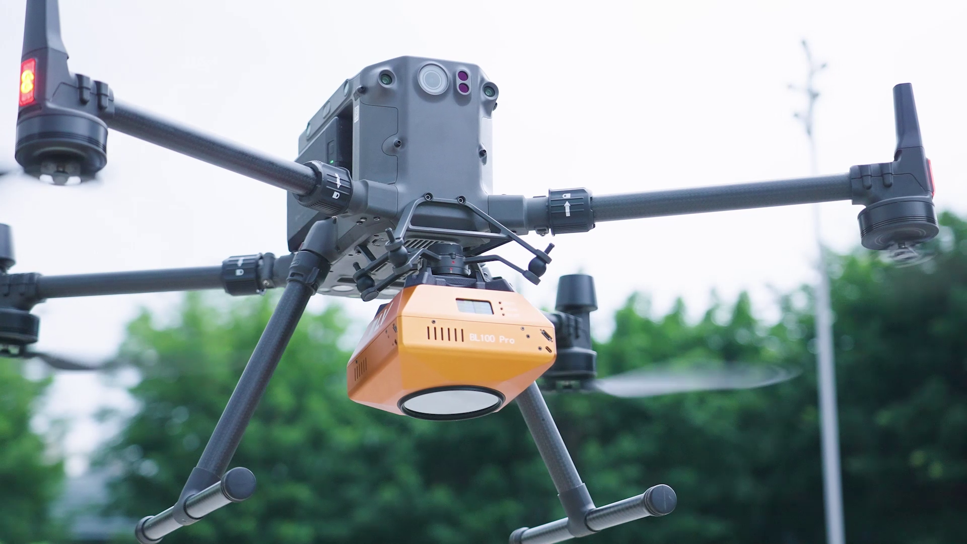
BL100 Pro
A new, innovative and affordable solution for even better 3D photogrammetric data collection provided by 5 cameras in one body.
BL6100 Xport
A stronger version of our solution for even better photogrammetric data collection, which is provided by a fullframe 61 megapixel camera in a quality body.