A professional tool for demanding tasks and high precision
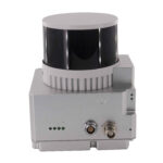
| Accuracy | 1cm per 100m |
| Point density | 140pts (100m/10m/s) |
| Dimensions | 13.6/9.4/9.1cm |
| Weight | 1kg |
| Measurement speed | Three measurement returns and 1,900,000 dots per second |
| Camera | Sony 26mp |
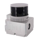
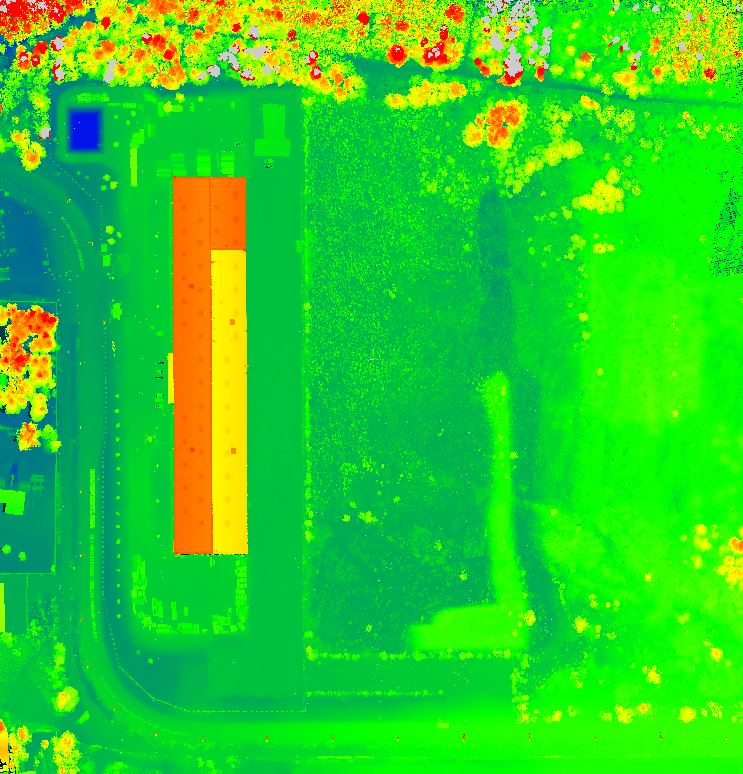
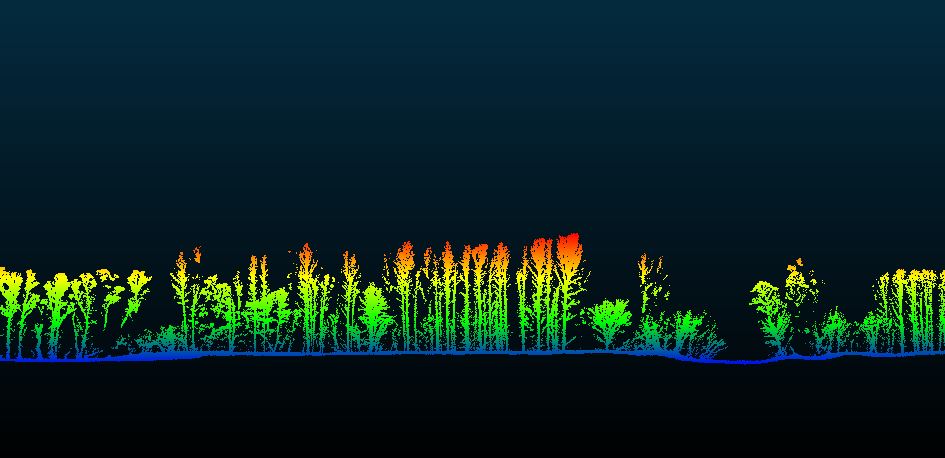
The GS-260X is an advanced tool for true professionals. This LiDAR is suitable for measuring short as well as longer range from a height of up to 300m. The excellent and accurate HESAI XT M2X 32-channel sensor provides a high-quality colored high-density point cloud. It includes a modern POS unit type 303. The tool is designed for combining aerial UAV and terrestrial mobile scanning from a car or ship.
It is characterized by ile penetration through dense vegetation, positional and altitude accuracy and with the possibility of adjusting to triple echo – 3 returns. The GS-260X is widely used in the mapping and geodesy industries, forestry, power line monitoring, agriculture, and facilitates data acquisition over large areas.
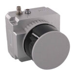
This type of LiDAR can be used in construction, passporting and demanding forest cover mapping. Also suitable for mapping network corridors, construction objects and road networks. Designed with a highly integrated design with longer service life and easy maintenance. Lidar is equipped with a gSpin310 POS system. Convenient operation with quick assembly and disassembly of the structure. 360° field of view for wider scanning range and higher operational efficiency.
- Use for UAV as well as mobile mapping
- Compatible with planning software
- A tool for demanding users at an affordable price
- Provides a coloured point cloud in high density and precision