Spatial data and information management


GoodMap
Online web application for managing map layers and digital information
The application is suitable for storing, publishing and creating map layers and objects for your projects. An ideal solution for managing the region of interest, a construction project or managing documentation that contains spatial connections.
Our GIS allows you to combine all types of geographic data, especially orthophotomaps, but also satellite images or publicly available maps. You can also publish and compare demographic and project data, field focuses, or insert and create custom map layers.
We provide tools to perform various analyses and models. This allows for a better understanding and observation of the relationships between geographical objects and planning of future activities. We can visualize geographic data in the form of interactive maps, graphics and charts. In the project team, this makes it easier to present and share information about the status of joint activities.
Use GoodMap
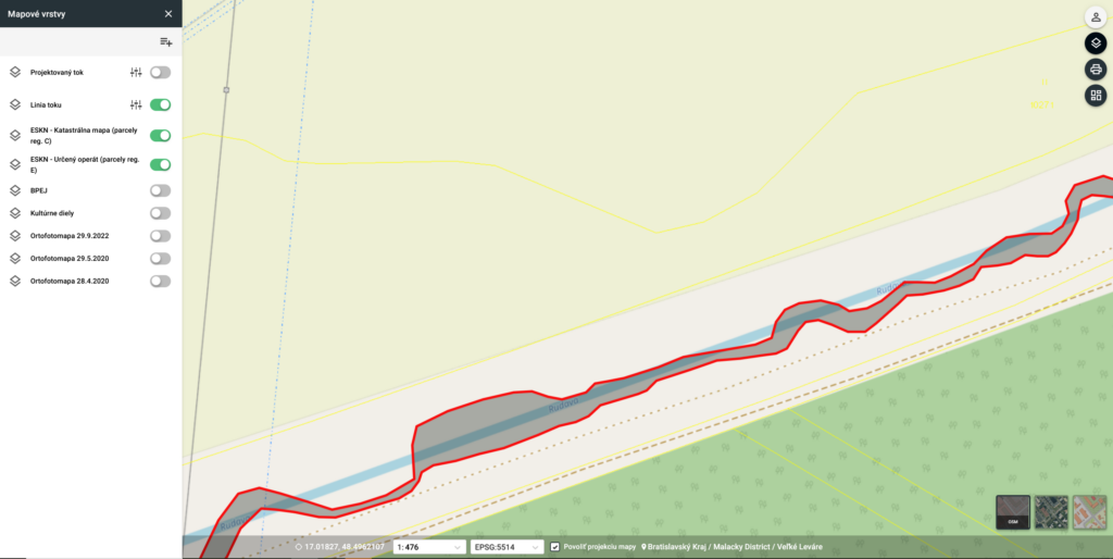
Landscaping design
Modification of the water flow for revitalization and adjustment of the surroundings in the form of a project that is added to the application and can be adjusted according to other relevant spatial layers.
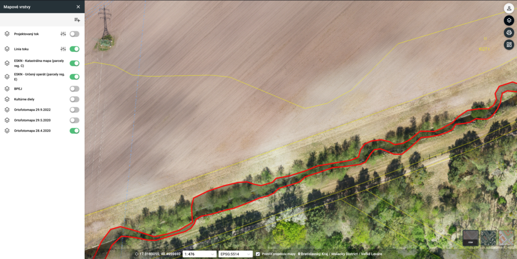
Data collection prior to implementation
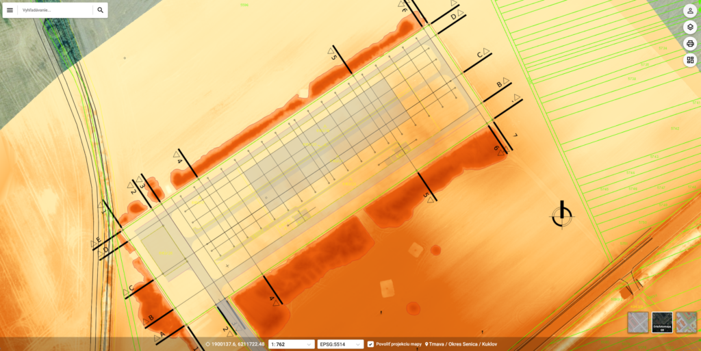
Aerial mapping and LiDAR scanning using UAVs to capture the actual state and insert data above the projected layer to capture further context.
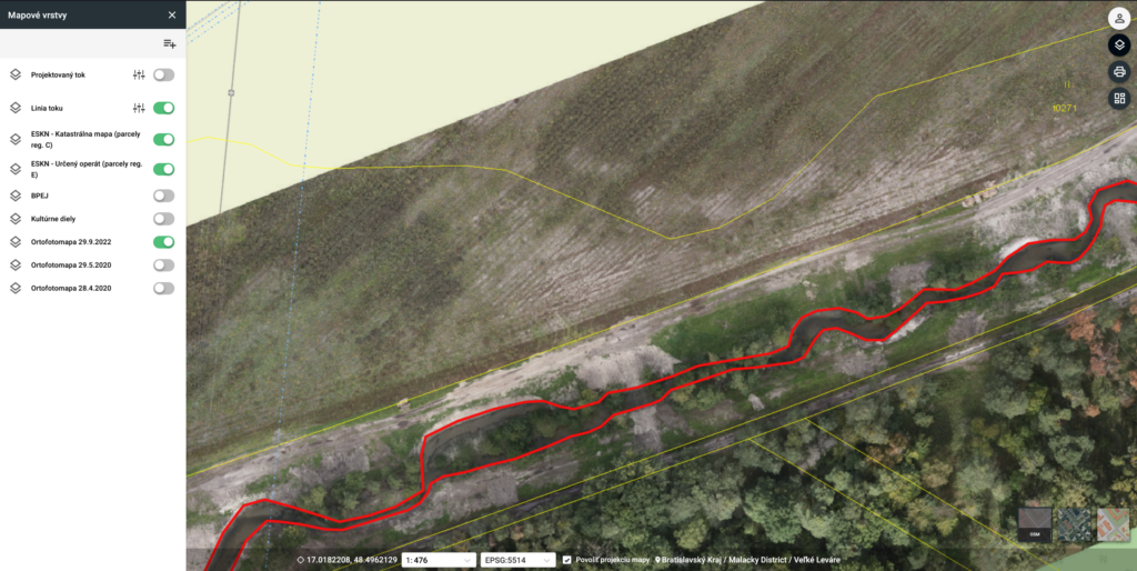
Data collection after implementation
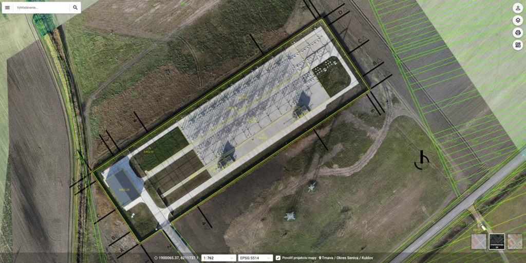
Captured changes after making adjustments in the field and comparison with the project intention, time schedule and with the impact on other activities related to monitoring.
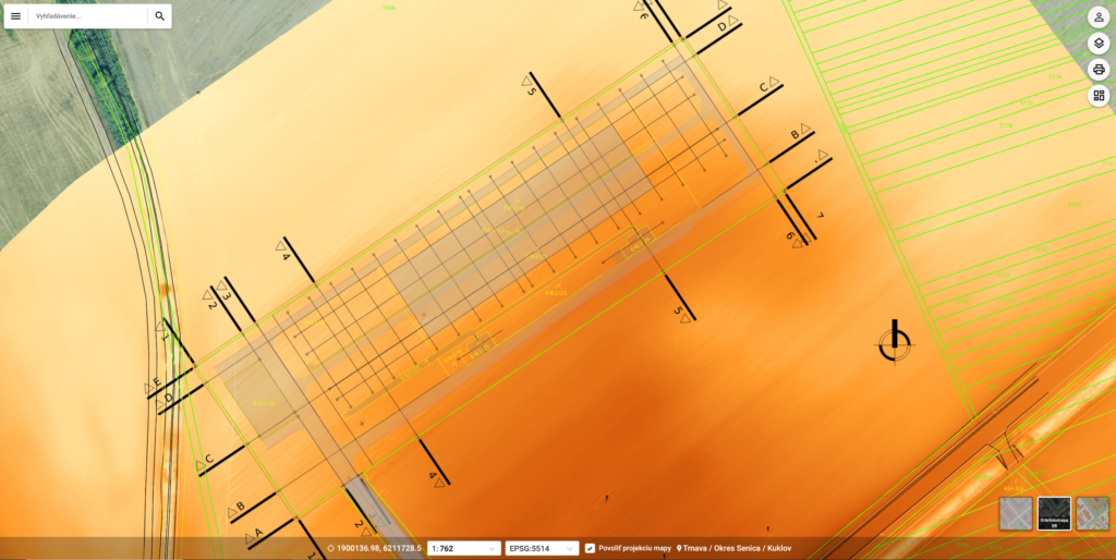
Acquisition and pre-implementation phase
Settlement and surveying of terrain, engineering networks, archaeological and geological exploration, delineation and preparatory phase of landscaping.
Landscaping and construction
Landscaping, calculations of deposited soil volumes, monitoring of construction progress and measurement of individual project phases.
Completion of the project and final approval
Measurement after construction, process control and commissioning, project evaluation and progress presentation.
Advantages of the GoodMap system
Implementing a GIS system brings many benefits, better decision-making, more efficient resource management and improved communication between different departments and organizations.
- Online platform
- functional support
- favorable conditions
- Tailor-made
Processes and planning
Implementing GIS in a company can also bring come challenges, one of the main ones is the need for quality and up-to-date data, but also training of personnel and adequate infrastructure.
- Deployment and activation
- infrastructure consultancy
- individual approach
- comprehensive training
The Goodmap data management platform is customized for each type of project, client and according to the difficulty of the assignment. It is possible to use our server or cloud, but it is also possible to place the entire environment on the client’s network. Data security, access hierarchy and personalized features deliver immediate results.
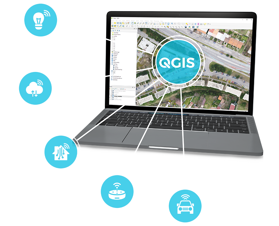
QGIS compatibility
We work with the open source software platform QGIS. It is a professional GIS application that is built on the principle of free and open source software (FOSS). Open source is generally any information available to the public, provided that the possibility of its free distribution is retained. QGIS functions allow you to prepare map and data data for further work. The programmed modules and connectivity of our GoodMap system allow for a unique combination of free software and a professional online application.
QGIS Training
We offer complete retraining of future OpenSource users of the QGIS platform, programming of modules exactly for the chosen purpose and provision of the necessary services for uploading to the online environment.
The uniqueness of this procedure and the efficiency of the work with this combination are mainly reflected in the time saved and financial resources of the user.
Creation of QGIS projects
We will prepare a complete project for the QGIS platform so that it is possible to import these documents directly into the GoodMap GIS application or into other applications that support this procedure.
- Custom layers
- Creation of objects
- Link to public data
- analytical tasks
TwinMap
We are changing the way we look at spatial data with the help of artificial intelligence
TwinMap is the answer to today’s challenges – an application that changes the way you look at spatial data. We create digital 2D and 3D twins of cities, villages, areas, logistics parks and line constructions.
What is TwinMap?
A tool that allows its users to overcome the problem of lack of necessary information and data, their insufficient quality or complete absence. Our solution includes tools for data analysis and record-keeping, but also offers functions for data acquisition, collection and consolidation. Important data creation processes for our map application are provided by an artificial intelligence algorithm, thanks to which we achieve faster and better results. For the application, we offer services of comprehensive data collection from the field using mobile and aerial mapping, scanning with LiDAR, underground mapping with georadar as well as 360° high-resolution imagery, or accurate geodesy.
Using TwinMap
Initialization background data
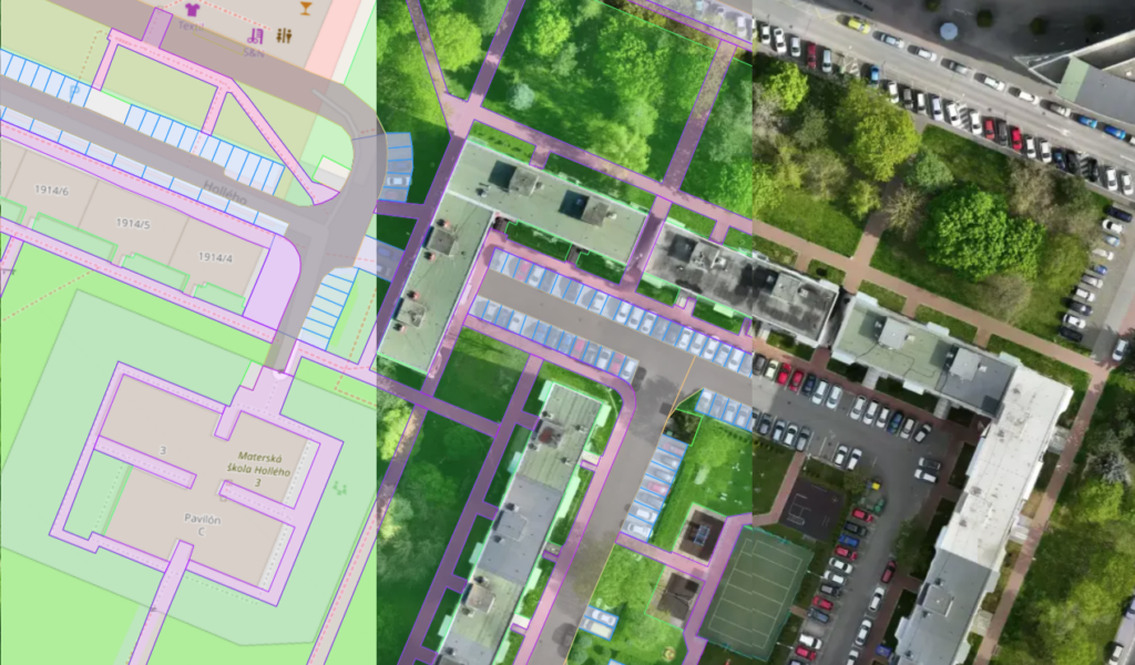
As part of the TwinMap solution, we offer detailed planigraphy and elevation mapping, including the insertion of a high-resolution underlying orthophotomap. This data is used to create specialised spatial registers.
- Mapping of planigraphy and elevation
- High resolution orthophotomap
- Import the current orthophotomap
- Continuous mapping of changing parts
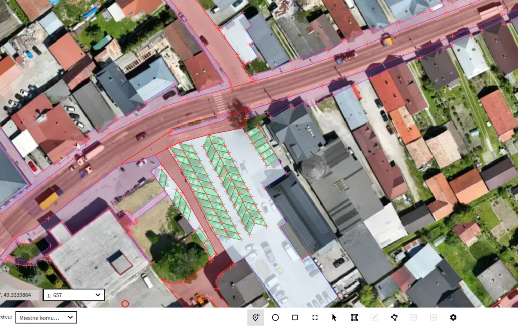
Data digitization and consolidation
Sophisticated tools for digitizing objects from the underlying data, mainly from orthophotomaps, point clouds, as well as from 360° degree images. Possibilities of automated data creation using artificial intelligence.
- View data in 2D and 3D
- Useful tools for digitization
- Efficient collection with artificial intelligence
- Data collection in both 2D and 3D

Passportization and creation of technical documentation of objects
Using specialized tools for passportization of objects from the initial underlying data, it is possible to create technical documentation of various types, including its attribute part.
- Data collection at the selected location
- Passportization of cemetery buildings
- Road signs, local roads and parking
- Sidewalks and cycle routes within the municipality and county
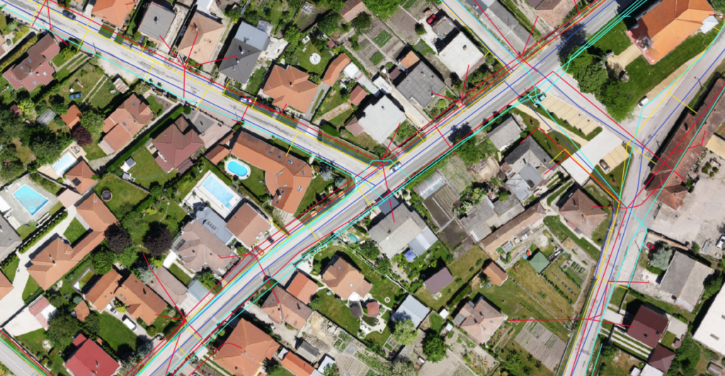
Creation of a technical map
The solution offers tools for creating technical maps showing the course of engineering networks, including their attributes such as planned inspections, material, service life, and failures.
- Utilities
- Evidence of attributes
- Imports of existing data
- Maintenance scheduling

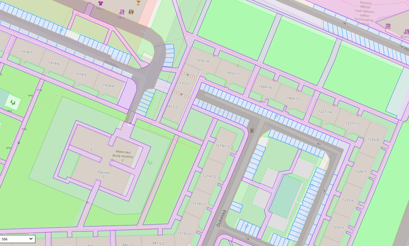
Spatial planning and cadastre
Combining spatial planning documentation with cadastral records, an orthophoto map and other data in the registers enables effective planning of the future development of the municipality.
- Obtaining spatial planning information
- Combining the land use plan with the cadastre layer and orthophotomap
- Effective land use development planning
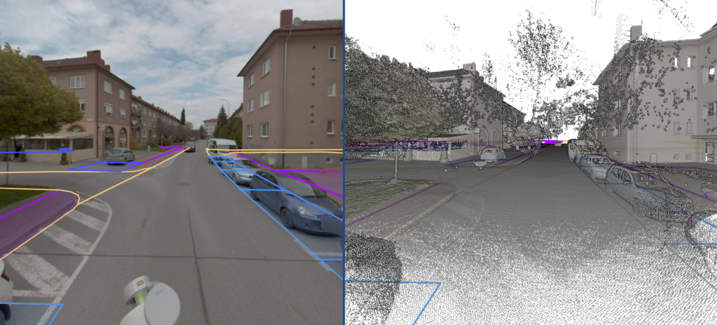
Pointcloud and Streetview
Point cloud view mode in combination with 360° street view enables viewing and accurate collection of 3D data
- Interconnect with 2D maps, 360° scenes and cloud points
- Fast and accurate 3D data collection
- Virtual tour
- Measurement of areas and distances in 3D
Open Data
The solution includes interfaces providing data on spatial registers through open interfaces to the public or third parties. It is easy to define the scope of data and the frequency of its publication. We use open API features, the ability to publish data to the public and interconnect with other applications.

Recording and analysis
The object registration option is suitable for importing existing records and simply searching and consolidating spatial registers without using a map.
Transparent statistical and graphical overviews of spatial registers provide a quick overview of the status of registers. Modern analytical tools are available to enable effective decision-making in everyday agendas. The application offers combining spatial registers with each other, advanced calculation tasks, graphs, tables and map layers.