Scanning with LiDAR (Light Detection and Ranging) technology
An innovative method of remote distance measurement based on the calculation of the propagation time of the pulse of the laser beam reflected from the objects we are scanning. Light detection and ranging (LiDAR) uses lasers to measure the height of objects. It is a distance measurement technology that samples with an incredible degree of accuracy and amount of points.
LIDAR works on the principle of sending light pulses. This pulse hits the ground, the object and returns to the sensor. It then measures how long it takes for the light to return. By recording the return time, the LiDAR measures the distance. It emits 100,000, 200,000 or 300,000 pulses per second. Every second, it receives approximately 15 impulses for every 1 meter pixel. Therefore, the point cloud is made up of millions of points. A modern method of using LIDAR is collecting data from the air while being placed on drones.
What can LiDAR generate?
Imagine you are walking in the forest. Then you look at the sky. If you can see the light, it means that the LiDAR pulses can also pass through. This also means that LiDAR can hit bare ground or low vegetation.
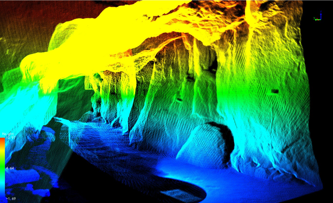
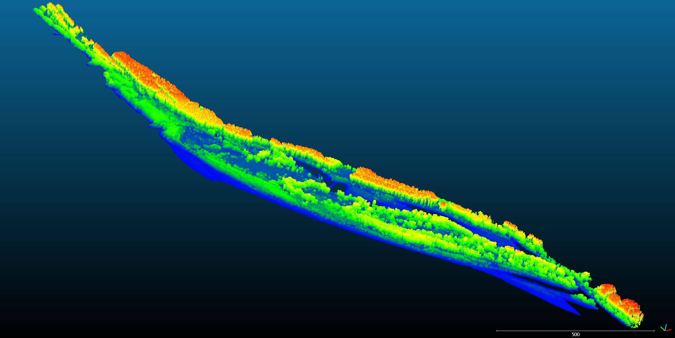
By using LiDAR, you get bare ground points, it is not X-ray radiation passing through vegetation. Instead, you’re actually looking through gaps in the leaves. When it hits the branches, you get more hits or returns. The number of returns of laser pulses, for example, decreases in the forest. As the light hits different parts of the forest, you get a “return number”. For example, you get 1., 2. and the 3. returns until it finally reaches the bare ground. If there is no forest in the way, the light beam will fall directly on the surface of the earth. LiDAR systems can record information from the top of a tree down to the ground. This makes LiDAR valuable in interpreting forest structure and shape.
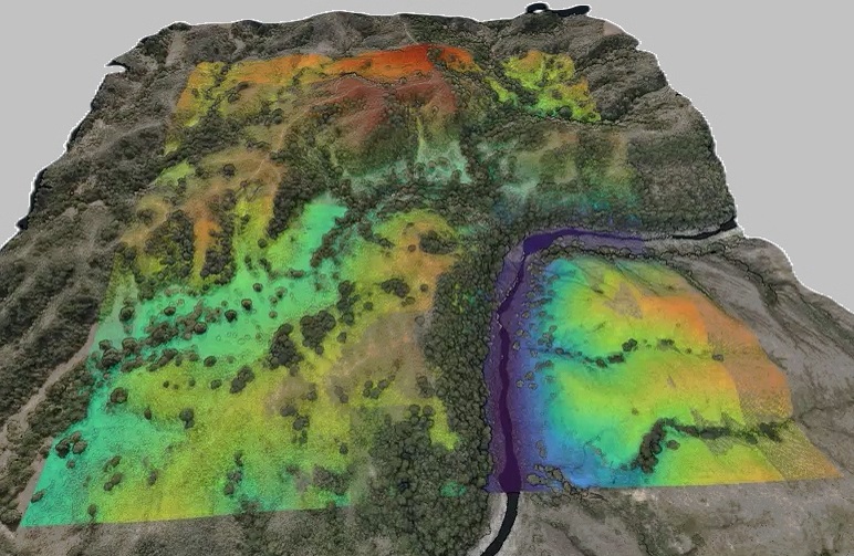
DEM – Digital Elevation Models are bare earth (topographic) models of the earth’s surface. Using only ground returns you can create a DEM. However, this differs from digital terrain models (DTMs) because DTMs contain contours. You can generate other products by using DEM. For example, you can create
- Slope (ascent or descent expressed in degrees or percentages)
- Aspect ratio (slope direction)
- Hillshade (shaded relief depending on the lighting angle)
- Digital surface model
It has the coordinate value “z” as well as “xay”. Elevation values are used everywhere, on roads, buildings, bridges and more. Before LIDAR, a ground survey or photogrammetry method was used to capture the z-coordinates, but this method was time-consuming. LIDAR made things easier and faster.
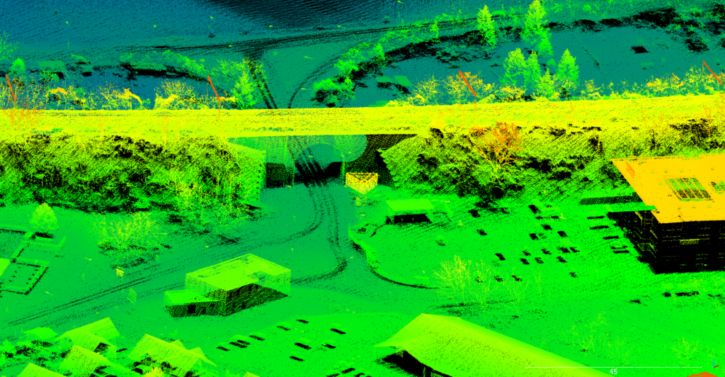
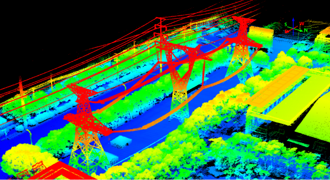
DSM – Digital Surface Model contains elevations from natural and built-up surfaces. For example, it adds elevation from buildings, tree canopies, power lines, and other elements.
CHM – Object height models give us the actual height of topographic features on the ground. We also call this type of elevation model a normalized digital surface model (nDSM).
First, take a DSM that contains natural and built features such as trees and buildings. Then subtract these heights from the bare earth (DEM). When you subtract them, you get the feature surfaces that represent the actual height from the ground.
The strength of LiDAR returns varies depending on the composition of the surface object that reflects the return. Reflectance percentages are referred to as LiDAR intensity. Many factors affect light intensity. For example, range, angle of incidence, beam, receiver and especially surface composition. An example is when the pulse is tilted further, the return energy is reduced. Light intensity is particularly useful for distinguishing features in land use/coverage.
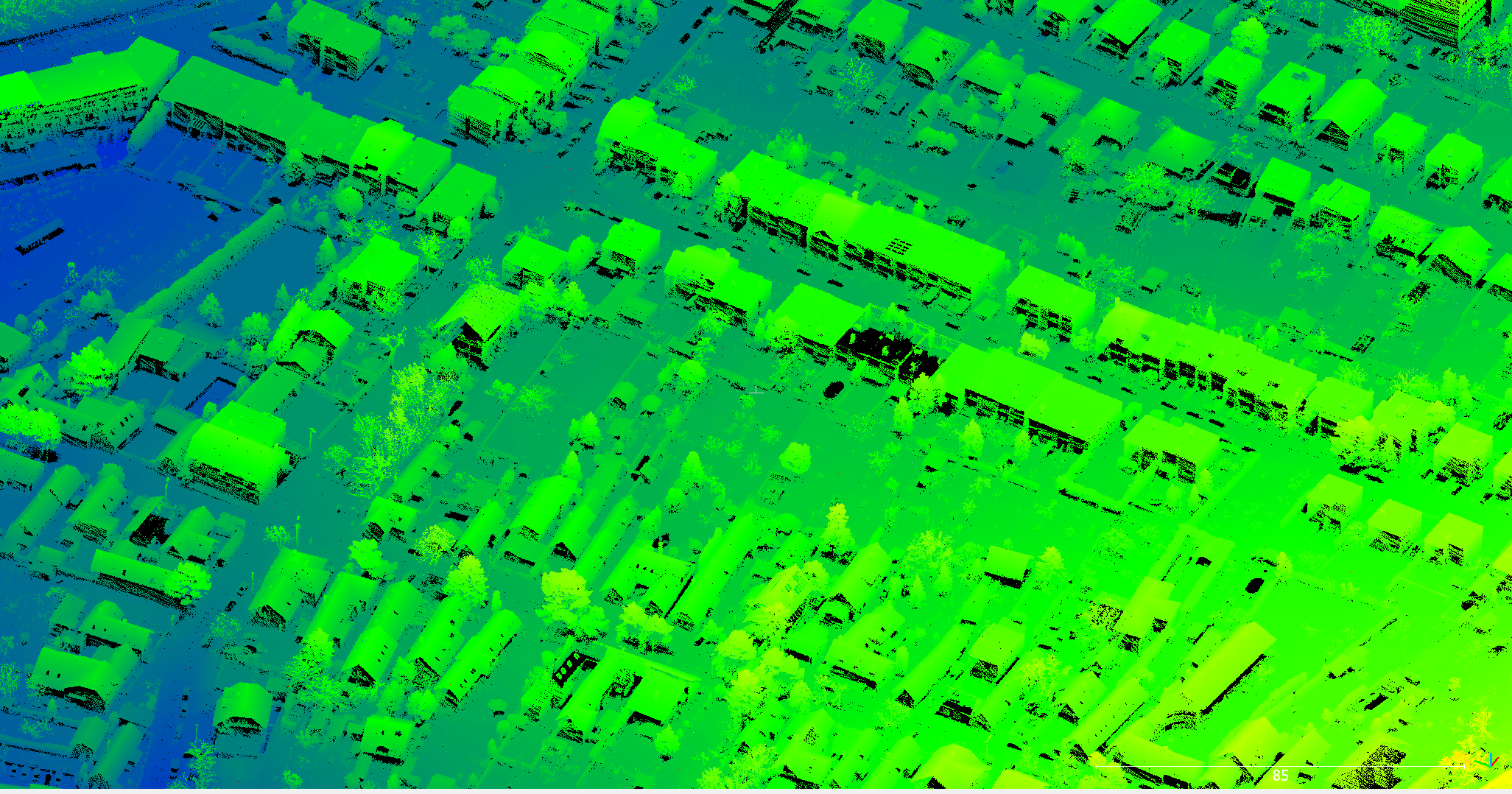
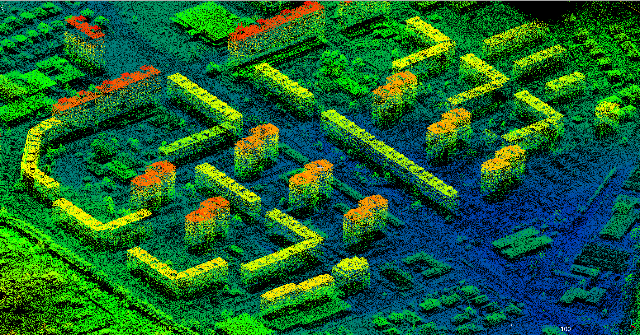
LiDAR point classification
There is a set of classification codes and classes, that the American Society for Photogrammetry and Remote Sensing (ASPRS) assigns to the LiDAR point classification. Classes can include soil, vegetation (low, medium and high), buildings, water, etc. A point classification can sometimes fall into more than one category. In this case, suppliers usually label these points with secondary classes.
What is the practical use of LiDAR?
The professional applications in which LiDAR is used are staggering. Foresters can use LiDAR to better understand tree and forest structure and shape. Archaeologists use LiDAR to find specific patterns in the ground that represent the potential for sites of ancient buildings and structures. Hydrologists define the shapes of streams and other river topographies.
Environmental assessment: Micro topographical data generated from LIDAR data is used in environmental assessment. Environmental assessment is carried out to protect plants and the environment. Remote Sensing and Surface Information (LiDAR) are used to find an area that is affected by human activity.
Forest planning and management: LIDAR is widely used in the forestry for planning and planting. It is used to measure the vertical structure of the forest canopy and also to measure and understand canopy bulk density and canopy base height. Another use of LIDAR in the forestry is to measure the height of a peak to estimate its root spread.
Forest fire management: LiDAR is becoming popular in forest fire management. The fire department is changing from reactive to proactive fire management. LIDAR helps monitor the potential fire area, which is called fuel mapping (fire behavior model).
Precision forestry: Precision forestry is defined as the planning and operation of a site-specific forest area to increase the productivity of wood quality, reduce costs, increase profits, and preserve environmental quality. A combination of LIDAR and photogrammetry is used to perform precision forestry.
Cities and towns: The city office uses LiDAR to survey the city. Because LiDAR has accurate and fast detection, it helps the city to know where things are and what changes have happened in the city. The Department of Urban Assessment can use LiDAR to find out what is going on in a public yard.
Agriculture: LiDAR helps the farmers find the area where expensive fertilizers are used. LIDAR can be used to create an elevation map of agricultural land, which can be converted to create a slope and solar radiation area map. Layer information can be used to create high, medium, and low crop production areas. The extracted information will help farmers save on expensive fertilizers.
Biodiversity for birds: LiDAR technology is being developed in search of detailed information about the forest. The forest is home to various species of birds, animals and insects. Science uses LiDAR data to analyze the forest (vertical structure) to see if there is a suitable place for it. The vertical structure of trees, shrubs and other plants tells what species can live and thrive in that area.
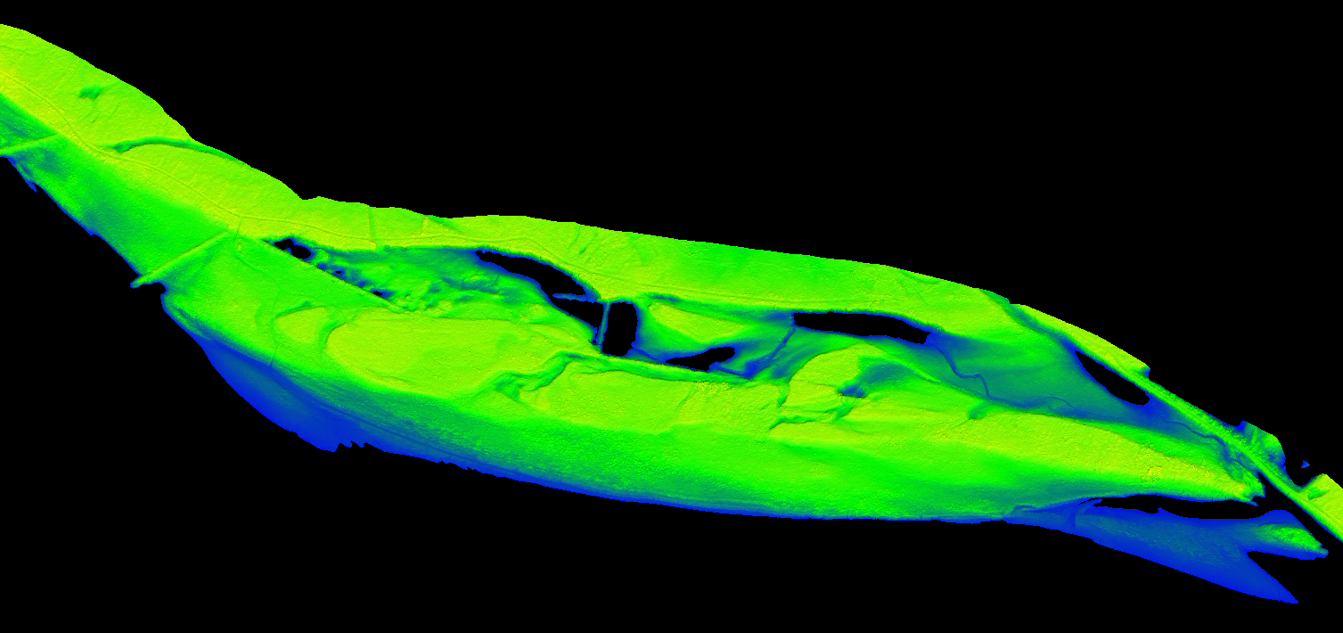
Basin and stream definition: LIDAR generated DEM is used to create stream area delineation. A high precision DEM is the main input and GIS software is used to create it. In this way, you can calculate the watershed for individual water channels and find out the current channel for flooding the land.
ELC (Ecological & Land Classification) provides biological and physical information about the landscape that helps in sustainable management. The ELC process helps in a variety of industries such as land use planning, environmental assessment, forest management, habitat management and many others. During landscape classification, high-resolution LiDAR data helps to understand the nature and type of soil, which will aid in the ELC process.
River survey: Green light (532 nanometers) LiDAR penetration is used to measure underwater. Water information is needed to understand the depth, strength of the flow, width of the river and other information. For river engineering, its cross-section data is extracted from LiDAR (DEM) data to create a river model that creates a flood path and flood margin map.
Pollution modeling: LiDAR can detect the polluting particles of carbon dioxide, sulfur dioxide and methane. This information helps researchers create a pollutant density map of the area that can be used for better city planning.
General 3D mapping: A surface model created from LiDAR is used to add graphical value to maps. A DEM (from LiDAR) is added below all layers that display a 3D view of the landscape. In particular, LiDAR (DEM) data is added to aerial photography to display a 3D view that facilitates the planning of roads, buildings, bridges and rivers.
Transport planning: Road LiDAR data helps the engineers to understand it and provide a road map to build it. Being a highly accurate technology, LiDAR helps to understand the width, elevation and length of an existing road. A road engineer uses LiDAR data to calculate cut and fill, culvert sizes, vegetation removal and more.
Railway infrastructure: Traditionally, the measurement of railway lines was carried out through a common survey system. Now, LiDAR can quickly take measurements of the railway line and the topographical and surrounding area of the railway track.
Wind farms: LIDAR is used in wind farms to calculate wind direction and strength. A LiDAR attached to the turbine helps change the direction of the blade to create more power.
Mining industry: LiDAR is also used in the mining industry for various tasks. It is used to measure the volume of ore by creating a point cloud and a series of photos of the space. This interval data is used to calculate the exact volume. It also serves to examine the area of quarries.
Recording building shapes: Ground-based LiDAR can be used to record the interior of a house. It can also be used to record interior design. This extracted data can be printed on a 3D printer and modeled. Or when remodeling a building, this recorded information can be used to restore the interior design.
BIM – Building Information Model: For GIS, it is a valuable tool that helps in planning, organizing and subsequent growth in the energy and utility industry. Effective management of energy systems is a complex challenge. GIS has enormous potential for planning, designing and maintaining facilities. It also provides a better, cost effective service.
Geology: In geology, the combination of aircraft LiDAR and GPS has evolved to the point where it is used for fault detection and uplift measurement. A combination of the above technology was used to find the Seattle bug in the state of Washington, USA. A NASA satellite called ICESAT, which has a LiDAR sensor, is used to monitor glaciers and analyze coastal changes.
Forensic purposes: 3D laser scanning or LiDAR is becoming very popular in forensics. Although this technology is new, it has been adopted by police departments and law enforcement agencies.